
Commercial Roofing Services
Drone Roof Inspection in High Point, NC
Document hard-to-map commercial roofs in High Point with labeled aerial imagery, visible findings, and a clear list of areas needing ground review.
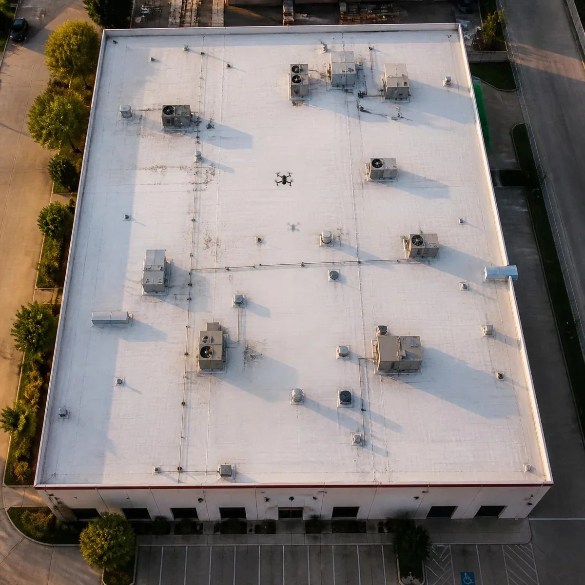
Aerial imagery gives an asset manager a broad view of roof areas that are difficult to map from the ground. For a High Point drone inspection, we use controlled flight to photograph accessible surfaces, record visible drainage paths, and locate details for a closer review. The image set is labeled by building and roof area. It can help compare sections or prepare a hands-on visit, but it cannot confirm a seam bond, membrane thickness, or moisture below the surface.
The National Weather Service recorded an EF-3 tornado touchdown in High Point in March 2010 and reported damage to more than 600 structures. After a later storm, a drone survey can help show visible movement or impact marks across a roof. The images document what is visible from above; a field inspection determines whether a defect opens the assembly.
Plan the image set
We define the buildings, flight area, access limits, and questions the images should answer before takeoff. The plan can focus on roof-area identification, visible debris, ponding patterns, displaced items, or comparison with earlier photographs. Lighting, wind, precipitation, airspace restrictions, and nearby operations affect whether a useful flight can proceed. We reschedule when safe or legal operating conditions are not met.
Each roof is assigned a consistent name or map reference. Overlap between images helps preserve context, while close views focus on selected details. We record the date and conditions and keep the original image set with the report. The final selection shows both the overall geometry and the specific area that needs a closer look.
A drone view has limits. It may not reveal concealed moisture, small seam openings, or the condition of a flashing beneath a cap. We flag uncertain features as candidates for hands-on inspection rather than labeling them failures. A commercial roof inspection can test those questions from the surface.
Useful for broad and changing roofs
Large or segmented properties can be easier to orient from an aerial view. We label each roof section and tie images to a site map, then note visible roof-top equipment, drainage locations, and access points without assuming what lies beneath the membrane. Repeat flights can show whether a visible condition has changed, provided the image angle, season, and scale are comparable.
High Point Market covers 13 city blocks organized into seven showroom neighborhoods. Commerce Concourse includes the transportation terminal, a five-wing, 11-story IHFC building, and the five-story Showplace building. Those documented clusters illustrate why a roof map can help identify which roof section belongs to which building; the drone images still do not reveal the assembly hidden below.
North Elm Market District also includes designer-oriented showrooms, Congdon Yards, The Generator woodworking resource, and a food hall. For a property owner in a dense block, imagery may help coordinate a roof walk around adjacent buildings and access routes. The owner’s permission, flight conditions, and operational limits control the plan.
Turn images into a condition record
We review aerial images for visible openings, displaced panels or accessories, debris, drain obstructions, surface changes, and areas that appear to retain water. We compare them with the known roof layout and note where shadows, glare, or image resolution limit interpretation. A dark region is not automatically a leak, and a clean overhead image does not rule out a concealed defect.
When an image suggests a repair, we locate it on the roof plan and request a ground-level view. Close inspection can confirm whether a seam is open, a flashing has separated, or debris can be removed without repair. A repair scope is prepared only from confirmed conditions. For a larger moisture question, an infrared moisture survey may complement the aerial record, with separate interpretation and confirmation.
We preserve the distinction between observation and diagnosis in the report. The image caption says what the camera records. The Diligence Notes says what a roofer confirms. This lets the owner share a clear visual baseline without overstating the meaning of a single frame.
High Point weather and flight timing
For Greensboro, NOAA lists 33.3 annual days reaching 90°F and above, with 68.5 nights when the minimum falls to freezing or lower. These are KGSO station values rather than measurements at the property. A seasonal image baseline should keep its capture date and conditions because shadow, surface moisture, and equipment activity change what an overhead frame shows.
A tornado event or hail report can prompt a time-sensitive image capture, but wind, rain, debris, and airspace conditions may delay it. If a roof has an active opening, emergency stabilization takes priority over aerial documentation. We can capture an overview after the site is safe and compare it with available pre-event images. That record can support a storm-damage roof review, followed by ground confirmation of each suspected defect.
Drone work may be useful for a portfolio across Piedmont Centre or for a single building with difficult roof access. The City reports Piedmont Centre has more than 170 companies; that fact indicates a large business campus, not a uniform set of roof systems. We confirm each property’s roof layout and coordinate permission before flight.
Images, labels, and next actions
The deliverable includes selected overhead images, building and roof-area labels, date and flight conditions, visible findings, and a list of follow-up areas. Where a close-up view is needed, we mark it for hands-on access. Images are retained in the property file so a future inspection can compare the same section. A roof condition report can connect aerial context to measured repairs and maintenance notes.
We can also capture a pre-work overview for a planned replacement or recovery. That helps document visible conditions and existing rooftop equipment before staging begins. It does not replace a material survey or confirm deck capacity. The scope states which question the imagery answers and what additional inspection is required.
Every flight ends with a status review: images received, areas needing ground confirmation, any urgent visible concern, and the recommended next step. The owner receives a record that is useful to the roof decision, not a collection of unlabeled photographs.
Before flight, confirm property permission, airspace considerations, safe takeoff and landing locations, privacy limits, and conditions that may affect imagery. Define the roof areas and questions the capture should answer. Images should be labeled by building, date, and orientation, and the report should identify blind spots or obstructions. Aerial photographs can help plan follow-up but may not verify seam adhesion, concealed moisture, or a repair's watertightness. Schedule a closer inspection where the decision depends on those details.
If the imagery shows a detail that cannot be resolved from above, identify the precise location for a hands-on follow-up. Record why the image alone is insufficient and which inspection method can answer the question, keeping the requested next step proportionate to the evidence.
Related Roofing Work
Storm and Roof Damage Repair
Storms that reach the Triad can lift edges, open seams and crack flashing. Start here:
- Wind Damage Roof Inspection and RepairInspect High Point commercial roofs after high winds, document edge and flashing conditions, stabilize exposure, and define measured repair limits.See repair options
- Hail Damage Roof Inspection and RepairAssess High Point commercial roofs after hail, document impact evidence, select focused testing, and define measured repairs without assuming causation.See repair options
- Tornado Damage Roof Assessment and RepairAssess High Point commercial roofs after tornado damage with released access, roof-zone mapping, temporary stabilization, and staged repair records.See repair options
Roof Assessment
Map the roof from above
Arrange a High Point drone survey for labeled images, visible findings, and a scoped follow-up roof walk.
Questions About Drone Roof Inspection
Can a drone inspection identify a roof leak?
It can record a visible opening or ponding pattern, but it cannot trace water below the membrane. We use the images to direct a hands-on leak investigation.
Can the drone replace a roof walk?
No. Aerial images do not confirm seam bond, flashing adhesion, or concealed moisture. We combine them with surface inspection when the decision depends on those details.
What can delay a flight?
Wind, precipitation, airspace restrictions, daylight, site operations, or access permission can limit a safe flight. We confirm conditions and revise the capture plan as needed.
Will you provide photos by building and area?
Yes. We label selected images by building and roof section, record the capture date, and list areas where a close inspection or test is still needed.
More questions? Ask our roofing team or call 555-555-5555.
Request a Roof Assessment in High Point
Send the address, the roof concern and when the roof can be reached. We walk the roof, photograph what we find and explain the repair or replacement options.
Roof Assessment
Commercial Roofing in High Point
Call, email or send the building details. We set a time to walk the roof and look at the leak, the drains and the flashing.